The district of Lahaul and Spiti in the Indian state of Himachal Pradesh consists of the two formerly separate districts of Lahaul and Spiti. The present administrative centre is Keylong in Lahaul. Before the two districts were merged, Kardang was the capital of Lahaul, and Dhankar the capital of Spiti. The district was formed in 1960.
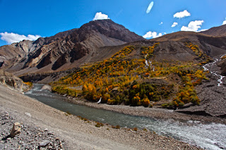
Few places on earth can mark so dramatic a change in landscape as the Rohtang Pass. To one side, the lush green head of the Kullu Valley; to the other, an awesome vista of bare, chocolate-color mountains, hanging glaciers and snowfields that shine in the dazzlingly crisp light, with just flecks of flora deep in the valley to soften the stark image. The district of Lahaul and Spiti, Himachal’s largest, is named after its two subdivisions, which are, in spite of their numerous geographical and cultural similarities, distinct and separate regions.
Lahaul, sometimes referred to as the Chandra-Bhaga Valley, is the region that divides the Great Himalayas and Pir Panjal ranges. Its principal river, the Chandra, rises deep in the barren wastes below the Baralacha Pass, and flows south, then west towards its confluence with the River Bhaga near Tandi. Here, the two rivers become the Chenab, and crash north out of Himachal to Kishtwar in Kashmir. Being closer to what rains the monsoon brings across the Rohtang pass from the south, Lahaul’s climate is notably less arid than Ladakh and Zanskar to the north and as a consequence, the key highway passes of Rhotang La and Baralacha La are much more prone to early snow than the higher examples further north. So it is that between late October and late March, heavy snows close the passes, and seal off the region. Even so, its inhabitants, a mixture of Buddhists and Hindus, enjoy one of the highest per capita incomes in the Subcontinent.
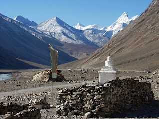
SPITI from its headwaters below the Kunzum La pass, the River Spiti runs 130km southeast to within the flick of a yak’s tail of the border with Tibet, where it meets the Sutlej. The valley itself, surrounded by huge peaks with an average altitude of 4500m, is one of the highest and most remote inhabited places on earth – a desolate, barren tract scattered with tiny mud-and-timber hamlets and lonely lamaseries. Until 1992, Spiti in its entirety lay off limits to foreign tourists. Now, only its far southeastern corner falls within the Inner Line – which leaves upper Spiti, including the district headquarters Kaza, freely accessible from the northwest via Lahaul. If you are really keen to complete the loop through the restricted area to or from Kinnaur, you will need a permit. The last main stop before reaching the restricted zone is the famed Tabo gompa, which harbours some of the oldest and most exquisite Buddhist art in the world.


1 Comments
Its great.
ReplyDelete